Welcome to our store!
Customer Support [email protected]

Chart Percy Isles to Port Clinton

$38.00 $30.40

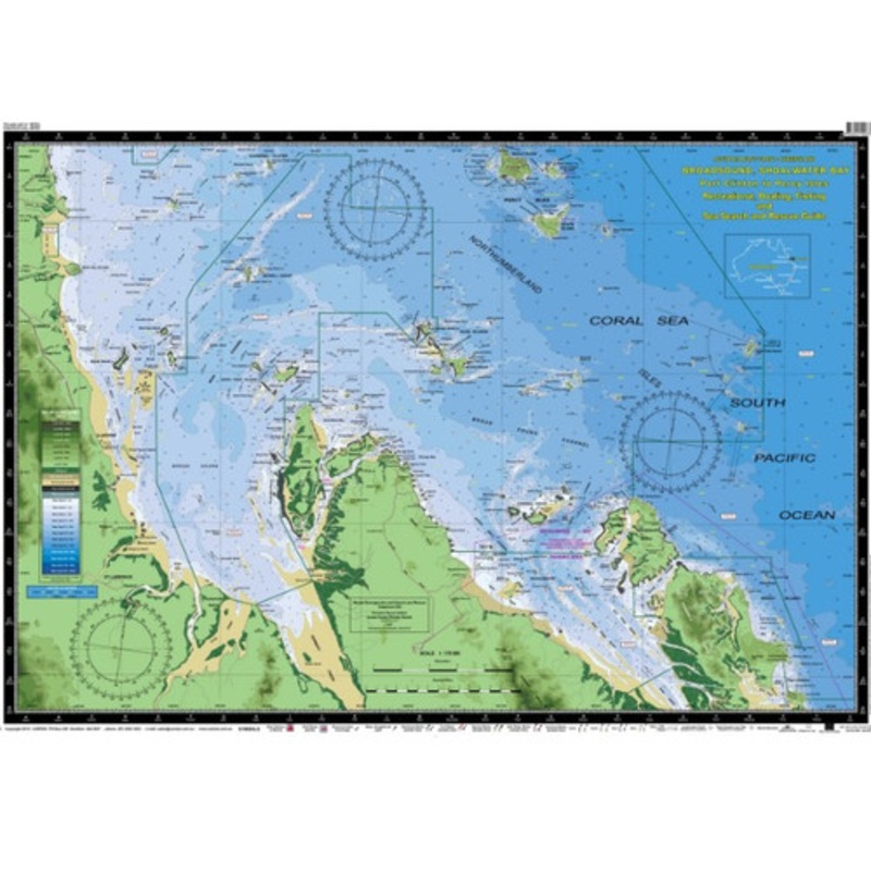
Product Description Chart Percy Isles-Port Clinton Laminated Size 61x88cm Features Water contoursare shades of blue becoming progressively darker as depth increases Land contoursbecome progressively darker as height increases Natural features,reefs,mangrov


SKU: MC634L Category:

Product Description

Chart Percy Isles-Port Clinton Laminated

Size 61x88cm

Features

  • Water contoursare shades of blue becoming progressively darker as depth increases
  • Land contoursbecome progressively darker as height increases
  • Natural features,reefs,mangroves, sand types, mud, salt pans and others features are visually realistically depicted
  • Grid referencesystem simplifies identifying positions for boating, fishing and rescue services
  • Marine EmergencySearch and Rescue contact details for Police and Volunteer Rescue Services phone numbers including radio frequencies monitored are easily located on the chart
  • Navigation symbolsare clearly explained on the chart without the need for supplementary handbook
  • Known informationsuch as names, heights, depths, seabed, GPS marks, obstructions and navigational tracks included
  • Satellite positionsderived from theWGS1984 datum can be plotted directly onto this chart
  • No fishing Zones,officially declared Smooth, Partially smooth, Open waters zones clearly indicated
  • Lesser known informationsuch as local knowledge of fishing and diving locations, local common names and information from latest satellite images are included at time of publication
  • An affordable chartand perfect gift or reference guide both at home or on holidays

Reviews

There are no reviews yet.

Be the first to review “Chart Percy Isles to Port Clinton”

Your email address will not be published. Required fields are marked *

Related products